Desert Crucible
Desert Geomorphology & Evolutionary Biology · Astronomy and Celestial Navigation · Rhino & Wildlife Tracking · Traditional Ecological Knowledge · Politics of Water · Drought resilience
Namibia opens the term with life in an arid environment, where water, shelter and resource use are daily practical questions. Across Etosha, the Namib, Damaraland and the Skeleton Coast, San and Damara teachers lead lessons in tracking, plant use, water finding and their approaches to caring for the land. Conservancy practitioners, Herero community partners and farmers teach about land use and livelihoods, alongside the study of water politics, mining and communal conservancies. Traditional ecological knowledge and desert ecology inform the fieldwork; conservation and resource-use questions connect it to Chitwan and the later African blocks. Night-sky observation introduces astronomy and celestial navigation.
- How do desert elephants and rhinos survive extreme aridity? How do people manage water, land and livelihoods in the same conditions?
- What does Namibia’s conservancy and community-tourism model offer conservation, and what are its limits amid mining, water scarcity and climate change?
- What do tracking instructors teach about reading the desert, and what responsibilities accompany learning and using that knowledge?
- What do these landscapes and questions of land and water use prompt me to reconsider about beauty, responsibility and justice?
- Immersion in Namibia's desert landscapes: Etosha's salt pan and wildlife, Namib-Naukluft's dunes and welwitschia, Damaraland's mountains and rock art, and the fog-shrouded Skeleton Coast.
- Scientific inquiry and citizen science: transects and biodiversity surveys across biomes, rhino and desert-elephant tracking, water-source mapping, and contribution to long-term monitoring with conservancies and researchers.
- Field teaching with San and Damara practitioners: desert tracking, plant use, water finding, and their approaches to caring for arid lands.
- Astronomy and celestial navigation under some of the world's darkest skies: traditional and modern navigation and star lore.
- Politics of water, drought resilience, and the economics of mining, agriculture and ecotourism: field visits and discussions led by farmers, mining representatives and conservancy practitioners.
- Core inquiry: How do desert ecosystems respond to extreme aridity, and how do land-management practices address water scarcity, mining and climate change? What approaches to resilience emerge from the field evidence and teaching?
- Integrated desert-ecology research: comparative studies across biomes and land uses (conservancy, park and mining concession), using transects, camera traps, tracking and separately agreed social surveys. Students prepare a comparative study; monitoring records follow the conservancies’ collection and reporting protocols.
- Water as life and politics: tracing water from fog/aquifers through ecosystems, communities, mines and farms; governance, equity and innovation.
- Epistemology of desert knowledge: compare the observations, methods and explanations taught by tracking instructors and land stewards with those used in scientific desert ecology, and examine how they inform decisions.
- Extended Project integration: students studying desert ecology, traditional ecological knowledge or resource politics collect primary data.
- Live and move safely in desert extremes: navigation, water discipline, heat/cold management, and low-impact camping (Grit, Judgement).
- Track and monitor desert-adapted megafauna (rhino, desert elephant) ethically and contribute to conservancy monitoring (Rigor, Impact).
- Learn tracking, plant use and water finding from San and Damara teachers, examining their methods and following agreements about the use of knowledge shared in lessons (Awareness, Judgement).
- Analyse water politics, mining, drought resilience and the conservancy/ecotourism model's promise and contradictions (Rigor, Impact).
- Practice celestial navigation and dark-sky astronomy, integrating scientific and cultural star knowledge (Rigor, Awareness).
Natural sciences. Desert geomorphology; evolutionary adaptation; astronomy & celestial navigation; wildlife tracking science.
Human sciences. Politics of water; mining economies (uranium, diamonds); Namibia's communal conservancy model (CBNRM case #1).
Epistemology. Tracking and hypothesis testing, including Liebenberg’s argument that tracking is the origin of scientific reasoning; attribution and agreed use of knowledge taught in the field.
Field Ledger. Aridity & drought resilience.
Resource Atlas. Mining vs water vs conservancies — Atlas case.
Ways of Knowing Journal. Tracking as observation and inference; crediting teachers and recording the terms on which their knowledge is shared.
- Desert expedition and survival: navigation in featureless/complex terrain, water discipline and finding, extreme-heat/cold shelter, tracking (rhino, elephant, predators), and low-impact desert camping.
- Wildlife tracking and monitoring: advanced megafauna tracking, camera-trap deployment/analysis, population-survey methods, and ethical observation/photography.
- Community-conservation and tourism study: practitioner-led teaching on Namibia’s conservancy model, land management and livelihoods; preparation for field visits and conduct as a guest.
- Risk management in arid extremes: heat illness, dehydration, flash-flood and wildlife hazards, and remote evacuation planning.
- Celestial navigation and reflective integration of science, culture and justice.
| Week 57 Desert Skills + Etosha | Survival, tracking, surveys | Desert survival and navigation; water discipline; wildlife surveys and tracking in Etosha; camera-trap deployment. |
| Week 58 TEK + Namib | Tracking knowledge, dunes, astronomy | Tracking, plant-use and water-finding lessons with San and Damara teachers; Namib dunes and welwitschia; dark-sky astronomy and celestial navigation. |
| Week 59 Water & Extraction | Damaraland, mining, water politics | Rhino/desert-elephant tracking; water-source mapping; field visits and discussions on mining, agriculture and ecotourism; conservancy analysis. |
| Week 60 Synthesis + Story | Tracking narrative, reflection | Comparative synthesis across biomes and land uses; produce a tracking narrative drawing on traditional ecological knowledge and field evidence; reflection; prepare for Okavango. |
Primary (recommended). Wildlife-tracking narrative (3–5 min film, extended photo essay or written story) drawing on lessons with San and Damara teachers and students’ observations of desert-adapted elephants and rhinos, alongside desert-ecology methods and water politics in Namibia. Credit the teachers whose knowledge informs the work and follow the agreed terms for its use.
Alternatives (from menu). Astronomy/celestial-navigation StoryMap under the darkest skies; a tracking zine based on field lessons and students’ records.
Narrative-craft guidance. What does field evidence show about desert adaptation and land stewardship? How can the account distinguish teachers’ explanations, students’ observations and the conclusions drawn from them?
Competencies emphasised. Attribution and agreed use of field teaching and recordings (Judgement, Impact); advanced tracking and desert-expedition narrative (Grit, Rigor); political ecology of mining and conservation (Awareness, Impact).
Integration w/ Exploration & Research. Extends desert tracking, practitioner-led field teaching and integrated ecology and political-economy research; connects to Chitwan’s conservation-and-justice questions.
Individually-accountable output. Extended Project desert-ecology/TEK/resource-politics primary data; individual reflective log.
Team output. Comparative desert-ecology dataset and conservancy analysis; monitoring records submitted through partner protocols.
Storytelling deliverable. Tracking narrative on Craft axis; ecology/political-economy analysis on Substance axis.
Primary competencies evidenced. Judgement, Rigor and Awareness foregrounded; Grit and Impact supporting.
Substance vs Craft. Desert-ecology research counts as Substance, the tracking narrative as Craft; the two are scored independently.
Moderation. Double-mark research and the treatment of shared knowledge, attribution and consent; calibrate storytelling against anchors.
Students compare conservancy, park and mining-concession land uses through transects, camera traps, tracking and separately agreed social surveys. Faculty set the comparative framework; students select independent-project evidence and prepare findings and a tracking narrative over four weeks.
Biodiversity transects, camera-trap deployment and analysis, population-survey methods, water-source mapping and celestial-navigation fixes produce measured evidence across biomes and land-use types.
Notes from field lessons and practitioner-led discussions support the qualitative inquiry. Separately agreed surveys and interviews with farmers, mining representatives and conservation practitioners address defined research questions. Reflective logs distinguish what was taught, what was observed and how students interpret it.
Students learn desert navigation, water management, wildlife tracking, camera-trap methods, low-impact camping and celestial navigation, then apply them to comparative fieldwork and camp routines across four weeks.
A wildlife-tracking narrative as a three-to-five minute film, extended photo essay or written story, with a celestial-navigation story map or tracking zine as alternatives. The work draws on students’ field records and teaching material cleared for this use.
Students compare the tracking and land-management practices taught in the field with scientific desert ecology and conservancy policy. Reflection connects science, culture and justice, and supports a personal account of stewardship with reasons for the position taken.
San and Damara teachers lead scheduled lessons in tracking, plant use and water finding, explaining the land and their approaches to its stewardship. Farm visits and conservancy sessions extend the teaching.
Teaching partnerships run across the four-week route, with tracking instructors, farmers and conservancy practitioners leading sessions in their areas of expertise. Conservancy monitoring follows established field protocols.
Tracking teams, wildlife surveys, navigation and camp duties require coordination and shared records across the four-week field program.
Students lead tracking and survey tasks, brief the group and practice heat, water and evacuation planning. Faculty and guides supervise route, wildlife and operational safety.
Students choose independent-project evidence and tracking-narrative treatment and undertake assigned field and camp roles. Guides and faculty determine the overall route and wildlife-safety arrangements.
Water discipline, navigation, camp routine and camera-trap servicing are allocated as standing duties, with heat-illness watch and wildlife-hazard roles assigned inside the faculty risk frame.
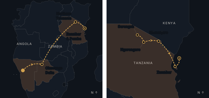
Four weeks of desert travel on foot across Etosha, the Namib dunes and Damaraland, with long tracking days in heat, water discipline and loaded low-impact camping throughout.
Hyper-arid heat by day and sharp cold at night, dune sun and dust, and the fog belt of the Skeleton Coast, with heat illness and dehydration managed as standing risks.
Twenty-five nights use desert camps across the route, with carried water and low-impact camp systems. Three nights use serviced accommodation during arrival and transfers.
Students manage drinking water, map sources and study coastal fog. No paddling, swimming, diving or other aquatic field activity is scheduled.
Reflective logs accompany tracking, surveys and desert camp work. No period apart from the group is scheduled.
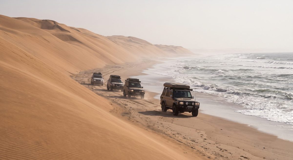
Delivery is field-based throughout — Etosha's salt pan, Namib dunes and welwitschia, Damaraland's mountains and the fog-bound Skeleton Coast — with tracking and direct observation raising the questions.
Desert geomorphology, evolutionary adaptation in welwitschia and desert-adapted megafauna, biodiversity transects across biomes, water-source hydrology traced from fog and aquifers, and dark-sky astronomy.
Desert adaptation, welwitschia and dune ecology are taught with water-source mapping and the politics of scarcity, alongside low-impact desert camping under rationed water for four weeks.
Tracking, plant use and water finding taught by San and Damara teachers, Damaraland rock art, and the question of how different knowledge informs Namibian conservation. Tracking methods are considered alongside desert science.
Students examine land and knowledge rights, water allocation among mines, farms and communities, and the distribution of conservancy and tourism revenue.
Mining concessions, commercial agriculture and ecotourism revenues are traced as competing water economies, with conservancy benefit distribution and drought-resilience investment examined through field visits and practitioner-led discussions.
San and Damara tracking instructors, land stewards and scientific ecologists explain their methods and understandings of desert environments. The Ways of Knowing Journal sets these accounts alongside conservancy governance and the student’s own written position on stewardship.